Singapore MRT System Map
About Singapore MRT System
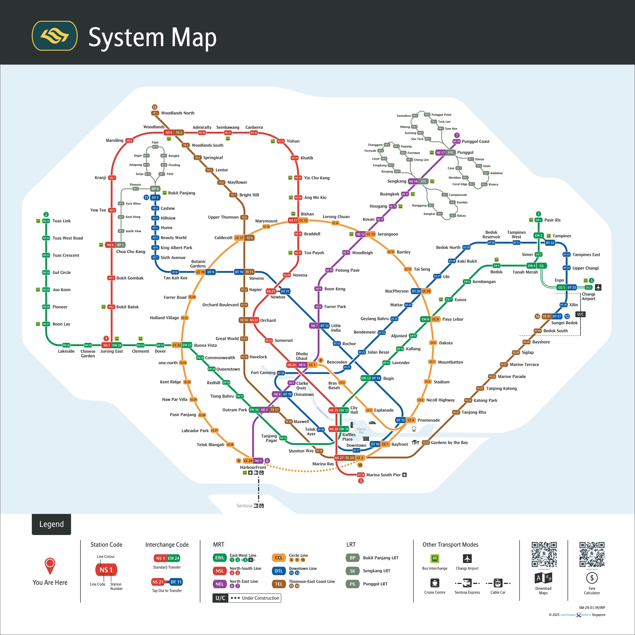
Singapore's Mass Rapid Transit (MRT) system is one of the most efficient and comprehensive metro networks in the world. With over 140 stations across 6 main lines, the MRT connects every major district in Singapore, making it the preferred mode of transport for millions of commuters daily.
Popular MRT Lines
- North-South Line (Red): Connects Jurong East to Marina South Pier
- East-West Line (Green): Links Pasir Ris to Tuas Link
- Circle Line (Yellow): Circular route connecting major districts
- Downtown Line (Blue): Serves the downtown area and eastern regions
- Thomson-East Coast Line (Brown): Newest line connecting northern and eastern Singapore