Dhoby Ghaut MRT Station
Dhoby Ghaut MRT Station in Singapore has 6 exits: Exit A, Exit B, Exit C, Exit D, Exit E, Exit F. Use the interactive map to see every exit on the ground, or share your location to get walking directions to the exit closest to you.
All exits at Dhoby Ghaut MRT Station
- Exit A Open in Google Maps
- Exit B Open in Google Maps
- Exit C Open in Google Maps
- Exit D Open in Google Maps
- Exit E Open in Google Maps
- Exit F Open in Google Maps
MRT stations near Dhoby Ghaut
- Bencoolen MRT Station 490 m
- Bras Basah MRT Station 580 m
- Fort Canning MRT Station 740 m
- Somerset MRT Station 800 m
- Little India MRT Station 920 m
- Rochor MRT Station 950 m
What's near Dhoby Ghaut MRT Station
Places whose closest MRT station is Dhoby Ghaut. Each page shows which exit to use and how far the walk is.
- Plaza Singapura 60 m · 1 min walk
- Spotlight 70 m · 1 min walk
- Dhoby Ghaut Green 90 m · 1 min walk
- Temasek Shophouse Garden 90 m · 1 min walk
- Orchard Road Presbyterian Church 100 m · 2 min walk
- Istana Park 110 m · 2 min walk
- Fort Canning Tree Tunnel 140 m · 2 min walk
- PSB Academy Cathay Campus 150 m · 2 min walk
- The Cathay 150 m · 2 min walk
- Istana Heritage Gallery 160 m · 3 min walk
- Wesley Methodist Church 170 m · 3 min walk
- Ji Hotel Orchard 170 m · 3 min walk
Browse every place by nearest MRT station ›
Station coordinates: 1.298947, 103.845492. Exit positions are sourced from LTA open data.
Find the Nearest MRT Station to Your Location
Need the nearest MRT station right now? Click the button below to use your device's live GPS to instantly find the closest Singapore MRT station. We'll show you exactly which exit is closest to you and how to get there.
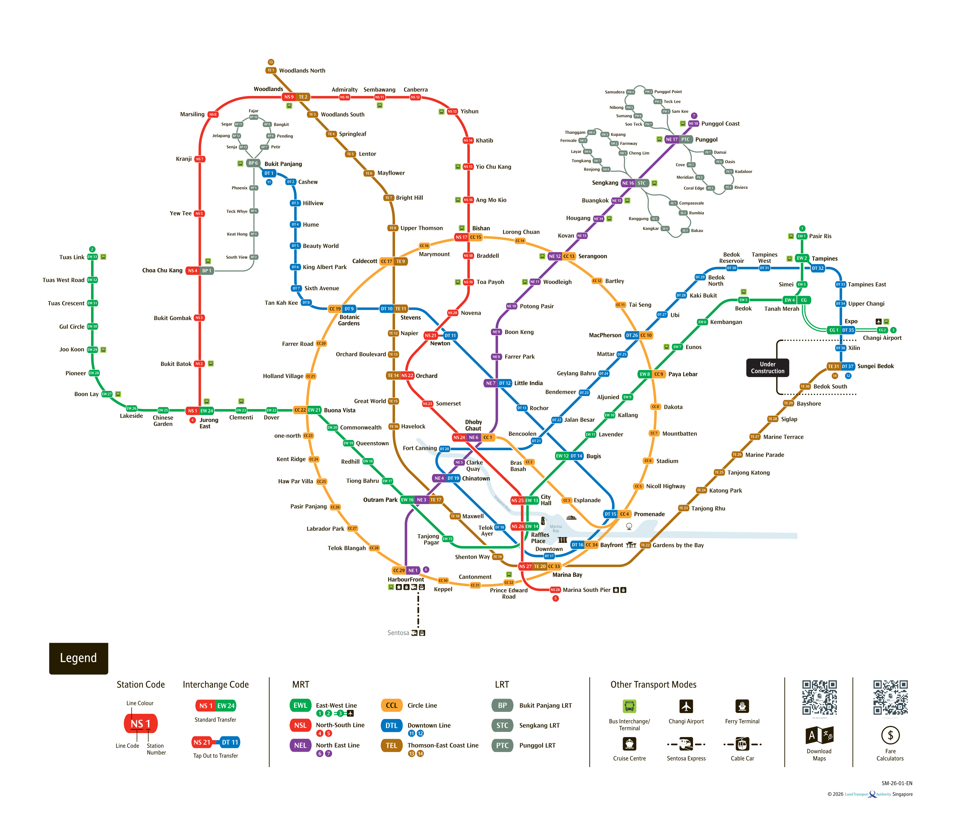
See the full Singapore MRT system map
All six lines and every station on one zoomable map — in English, 华文, Bahasa Melayu and தமிழ். Plan a route and fare between any two stations while you are there. Open the system mapSingapore Mass Rapid Transit (MRT) System
Singapore's Mass Rapid Transit (MRT) system is a world-class metro network that forms the backbone of the city-state's public transport. Boasting over 140 stations and 200km of track, it offers a fast, reliable, and comfortable way to travel across the island. Knowing the right station exits will save you time and help you reach your destination smoothly.
Explore Major MRT Lines
North-South Line (NSL)
Connecting the North (Jurong East, Woodlands, Yishun) to the South (Marina South Pier).
East-West Line (EWL)
Running from Pasir Ris and Changi Airport in the East to Tuas Link in the West.
North East Line (NEL)
A fully automated line connecting HarbourFront to Punggol through the city center.
Circle Line (CCL)
An orbital line providing easy suburban transfers and linking all radial lines.
Downtown Line (DTL)
Serves the Bukit Timah corridor, the central business district, and the East.
Thomson-East Coast Line (TEL)
Improving connectivity from the North to the East Coast via the Central Business District.